February 6, 2023
This Article is prepared by George Powell of the Blue Mountain Watershed Trust (BMWT) regarding the proposed closing of former Simcoe County Road 91 (Cty Rd 91), now owned by the Township of Clearview (Clearview), and its replacement by the reconstruction of Nottawasaga Sideroad 26/27 to a rural township road standard.
Proposed Closing of former County Road 91 and Reconstruction of Clearview Sideroad 26/27 to an all Weather Township Sideroad
BACKGROUND
Cty Rd 91 has served the area as a major intercounty transportation link for over 100 years. It was recently improved as a requirement of the Walker Industries (Walker) Duntroon Quarry hearing decision, which approved the operation of a 67 hectare (168 acre) quarry directly across Cty Rd 91 from their existing, and now depleted, 47 hectare (116 acre) quarry.
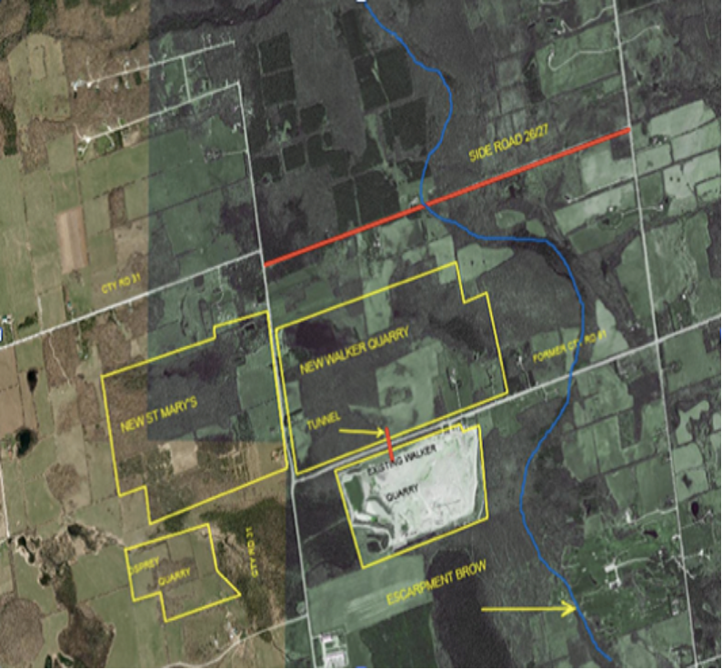
Aerial photo of the Walker and St Mary’s Quarries west of Duntroon
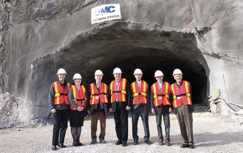
Walker Tunnel between existing and new Quarry posted in the Clearview Echo November 3, 2015 shown in red on the Aerial photo above.
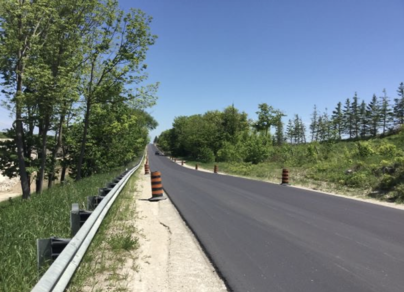
Looking east on resurfaced Cty Rd 31 on June 9, 2020, to the south Is the new Quarry to the north is the existing quarry. This section of Cty Rd 31 is to be closed and the property transferred to Walker when Side Road 26/27 is reconstructed.
Clearview has entered into an agreement with Walker that proposes to reconstruct Sideroad 26/27 and use it as the replacement for Cty Rd 91, which Clearview then plans to close in connection with the further development of the new Walker quarry. Sideroad 26/27 currently serves only two properties from Grey County Road 31 (Osprey-Clearview Town Line) to the brow of the escarpment and is maintained in this section all year to service these homes. At the intersection of Grey County Road 31 the signage indicates Sideroad 26/27 is a Dead End.
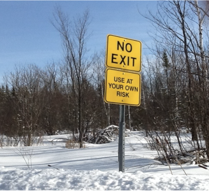
Sign on Sideroad 26/27 just past intersection with Grey County Road 31 February 11, 2018
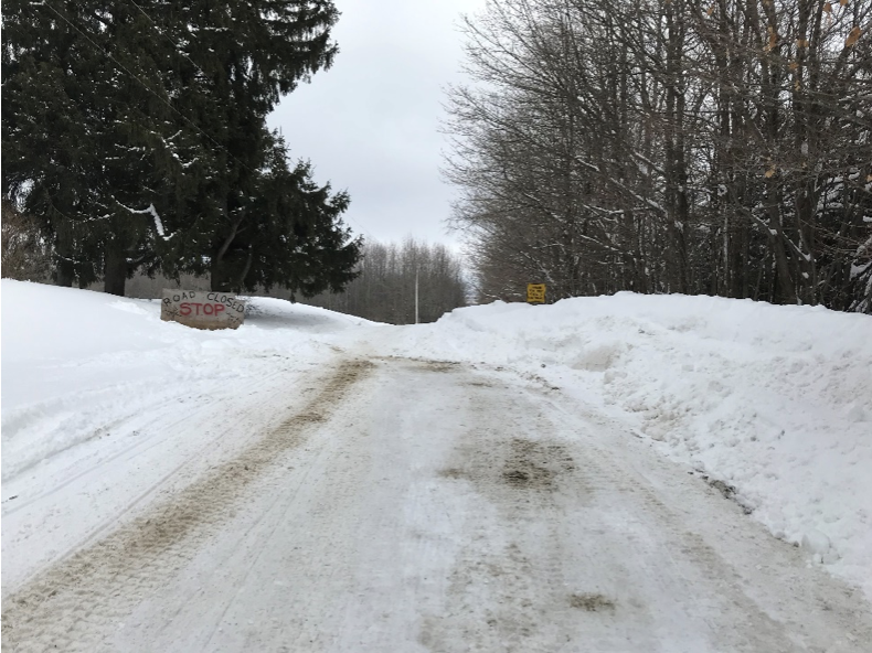
Top of Brow looking east towards Clearview Concession 10, Feb 11, 2019
From the brow of the steep slope to Clearview Concession 10, Sideroad 26/27 is not maintained in the winter months and is significantly impacted by erosion during the Spring Freshet and wet weather events. On the steep slope Walker owns the property on the southside of the road and on the northside it is Provincial Lookout Point Park property. The Bruce Trail crosses Sideroad 26/27 approximately 200 meters east of the prow. There are four private properties below the slope that can be accessed from Concession 10 during summer months, these properties do not at this time require all season access.
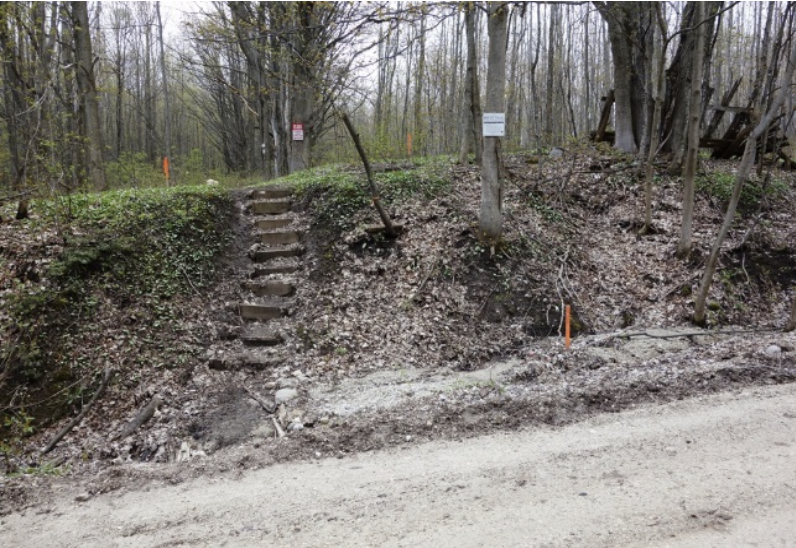
Existing Bruce Trail Crossing note erosion April 23, 2016
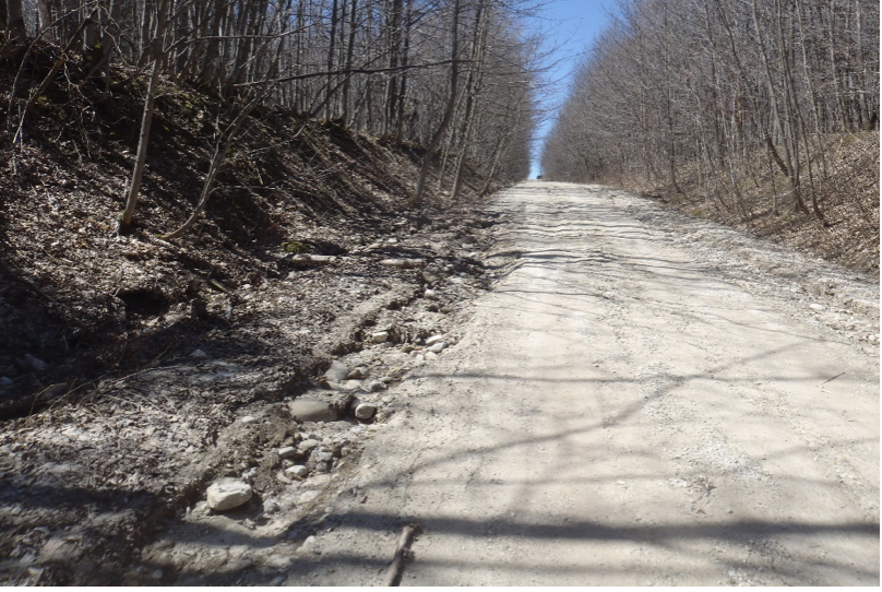
Sideroad 26/27 looking west up steep slope April 23, 2016 to reconstruct the road requires significant clearing and sophisticated road drainage design.
In the steep slope sections, two groundwater seeps are evident. The road is heavily rutted. Further, tributaries of the Pretty River run beside and through the road easement and would need to be realigned to permit the reconstruction.
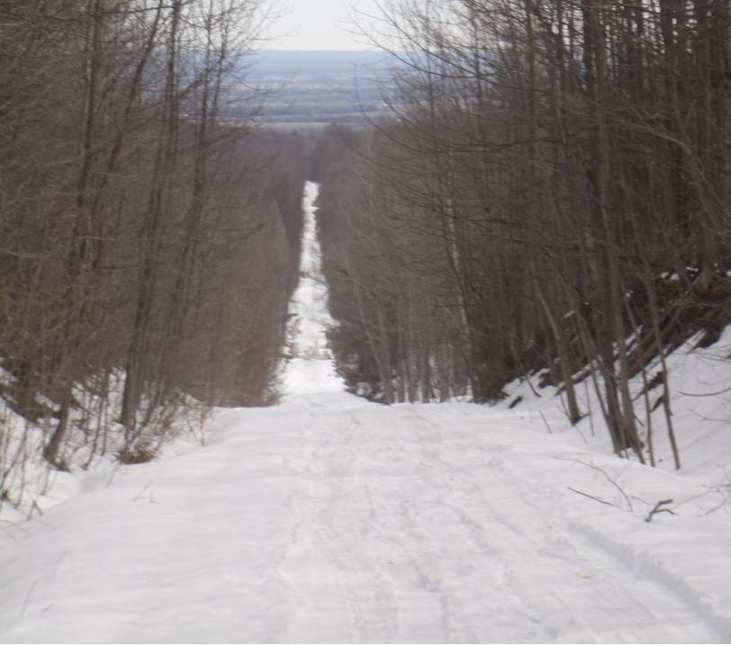
Looking east on Sideroad 26/27 note dark areas near bottom of the steep slope indicating where two seeps are present February 11, 2019
Our environmental consultant (North- South Environmental Inc.) located over 13 wetlands within the easement, significantly more than reported by Clearview. As well, the Brook trout spawning and bat habitat are at risk. Municipal maintenance efforts have resulted in significant amounts of gravel and runoff filling in Pretty River trout spawning areas downstream of Sideroad 26/27.
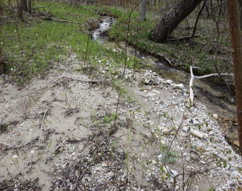
Gravel runoff off Sideroad 26/27 to a headwater tributary of the Pretty River April 23, 2016
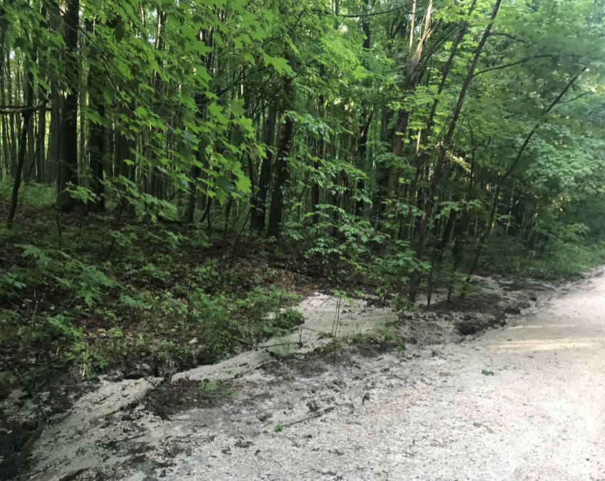
Gravel runoff towards the north, off Sideroad 26/27 in the steep slope section June 23, 2020
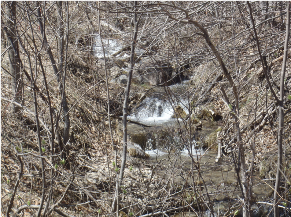
Tributary of Pretty River April 23,2016 looking South before it crosses Sideroad 26/27 in a 30 inch culvert
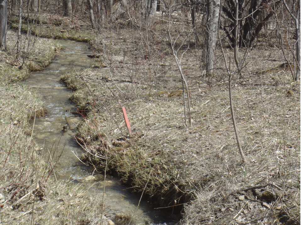
Tributary of Pretty River April 23,2016 looking North after crossing
Sideroad 26/27 in 30 inch culvert considered Brook Trout spawning habitat.
For years Clearview proposed to carry out the proposed reconstruction of Sideroad 26/27 as a Schedule “A+” project under the Municipal Class Environmental Assessment (MCEA) process, which is a process under Ontario’s Environmental Assessment Act that is required to be followed by municipalities. Under the MCEA, a Schedule “A or A+” project is defined as one that is limited in scale and has minimal adverse environmental effects. Schedule “A or A+” projects are considered pre-approved and may proceed to implementation without following the full MCEA planning process. This is certainly not the case.
The key facts of Clearview’s proposal in BMWT’s view, are the following:
1. There would be a dramatic increase in traffic on Sideroad 26/27 and other regional roads if Cty 91 was closed.
2. The proposed reconstruction would result in environmental impacts on a tributary of the Pretty River that would require realignment.
3. Environmental impacts on natural heritage features, i.e., woodlands and wetlands within the 26/27 easement, would occur as a result, of the reconstruction.
4. Clearview would be required to provide complex erosion and stormwater control systems to reconstruct Sideroad 26/27, a particular problem in the steep slope section of Sideroad 26/27 where there are two ground water seeps crossing the road.
5. The proposed reconstruction would impact fisheries, and in particular spawning habitat of Brook Trout in the Pretty River tributaries.
6. The reconstruction would also impact endangered species, like bats, and their habitat.
7. The cost of the proposed reconstruction is now estimated at over $ 4.0 million. This estimate significantly exceeds the MCEA Schedule “A” limit of $ 2.6 million.
From the very beginning of the proposed reconstruction of Sideroad 26/27, BMWT has opposed Clearview’s position that their undertaking is a Schedule A+. Even when the Ministry of the Environment Conservation and Parks’ (MECP) advised us in May 2020 agreeing with Clearview’s assessment of the proposed reconstruction as a Schedule “A+” undertaking and providing to us no reason why this was their opinion. Finally in November of 2022, based on additional information the BMWT and others provided to the MECP informed Clearview that they were re-considering Clearview’s classification. On December 22, 2022, the MECP advised Clearview that it now disagreed with Clearview’s proposal to carry out the work as a Schedule “A+” undertaking. Instead the MECP has raised, or “Bumped Up”, the undertaking to a Schedule “C” and this schedule requires alternatives to be considered, addressing social and economic issues, and seeking public input. BMWT has been fighting for Clearview’s proposal to be classified as a Schedule “C” undertaking since November 2015.
The Ontario Land Tribunal hearing related to Clearview’s appeal for a development permit and approval of an amendment to the Niagara Escarpment Plan has now been deferred till March 31, 2023.
WHAT IS NOW REQUIRED
A Schedule “C” MCEA requires completing a series of phases:
Phase 1: Define the Problem,
Phase 2: The Development of Alternative Solutions,
Phase 3: The Development of Alternative Designs and the arrival at a Preferred Alternative,
Phase 4: The Preparation of an Environmental Study Report (ESR) for the Preferred Alternative, the advertisement of the ESR and a 30-day period for agency and public review, and
Phase 5: Implementation of the Project.
Given that alternatives are required to be looked at under the MCEA for a Schedule “C” undertaking, Clearview’s proposed reconstruction may ultimately not be the preferred solution. In that case, the significant time, effort, and funds expended by Clearview will have been a waste of tax-payers money. Other interested parties, like BMWT, have also dedicated substantial resources to this matter over the past eight years.
Public consultation is now required and recent surveys by the Niagara Escarpment Commission show little community support for what Clearview is proposing. In any event, the requirement to carry out a Schedule “C” process will be considerably more involved, take more time and funding and must be successfully completed before Clearview can proceed further with implementation.
CONCLUSION
Clearview if it intends to carry out a Schedule “C” MCEA undertaking will now need to consider alternatives and consult with the public. They will need to consider the impact of their undertaking on the inter-county transportation network between Simcoe and Grey Counties and the Municipalities of Grey Highlands, the Town of the Blue Mountains, Collingwood and Wasaga Beach.
BMWT has put forward an option that would not involve the closing of Cty Road 91 or the reconstruction of Sideroad 26/27 down the Escarpment’s steep slope. Under BMWT’s proposal, the steep section of Sideroad 26/27 would be closed to vehicles and paths would be provided for public access to the Bruce Trail. Parking areas at the top and toe of the steep escarpment slopes could be provided. The steep slopes would be provided with erosion protection and revegetated. Access to all the private properties on Sideroad 26/27 could be accommodated and there would be a significant saving in costs. This option does not impact the area transportation network and enhances the Niagara Escarpment Ecosystem.
We believe Clearview should seriously consider the above “Do Nothing Alternative”.
Yours truly
George Powell
Retired Professional Engineer
Vice Chairman
Blue Mountain Water Action Committee
705 443 8443


